收藏0人
Training Course on GIS and Remote Sensing in Disaster Risk Management Course
- 会议时间:2021-01-11 至 2021-01-15
- 会议地点: Datastat Research Monrovia St, Nairobi, Kenya,Nairobi,Kenya 周边酒店预订
- 主办单位: Datastat Research
发票类型:
不支持开票
参会凭证:其它
"Only the best!"
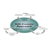
Training on Geographic Information Systems (GIS) and Remote Sensing in Disaster Risk Management & Climate change is job oriented and thus the trainee will have a chance to secure employment in disaster risk management in the ministry of environment. The course will be meant for those professionals who are in need to either further or acquire skills on the application of GIS and RS in their organization in the field of disaster management. The trainees from variety of organization are invited .. continue reading for training e.g. Institutions of physical planning, professionals and private GIS and RS related firms. · Group discussion: How can GIS and RS be used to map existing buildings, infrastructure, land use and critical facilities located in potential hazard areas. Group discussion: How can GIS and RS be used to map existing buildings, infrastructure, land use and critical facilities located in potential hazard areas.
Training on Geographic Information Systems (GIS) and Remote Sensing in Disaster Risk Management & Climate change is job oriented and thus the trainee will have a chance to secure employment in disaster risk management in the ministry of environment. The course will be meant for those professionals who are in need to either further or acquire skills on the application of GIS and RS in their organization in the field of disaster management. The trainees from variety of organization are invited .. continue reading for training e.g. Institutions of physical planning, professionals and private GIS and RS related firms. · Group discussion: How can GIS and RS be used to map existing buildings, infrastructure, land use and critical facilities located in potential hazard areas. Group discussion: How can GIS and RS be used to map existing buildings, infrastructure, land use and critical facilities located in potential hazard areas.

Datastat Research
Monrovia St, Nairobi, Kenya
Kenya
温馨提示
酒店与住宿:为防止极端情况下活动延期或取消,建议“异地客户”与客服确认参会信息后,再安排出行与住宿。
退款规则:活动各项资源需提前采购,购票后不支持退款,可以换人参加。

会议地点
推荐会议
同专业会议
- ICSMFC 2020: 14. International Conference on Sports Marketing and Fanatical Consumption
- ICSDCSB 2021: 15. International Conference on Structural Design of Cable-Stayed Bridges
- ICWT 2021: 15. International Conference on Wine and Tourism
- ICPADE 2021: 15. International Conference on Physical Activity and Developing Endurance
- ICTSPT 2021: 15. International Conference on Timber Structures, Preservation and Treatment
- ICSRDPR 2021: 15. International Conference on Structural Robustness Design and Performance Requirements
- ICDVS 2021: 15. International Conference on Dynamics of Viscoelastic Structures
- ICIHTP 2021: 15. International Conference on Innovation and High-Technology Production
- ICREDA 2021: 15. International Conference on Risks of Eating Disorders for Athletes
- ICCETET 2021: 15. International Conference on Construction Engineering Technology and Emerging Trends
同城会议
- 【Energy Reports期刊出版】 2023年能源与环境工程国际研讨会(CoEEE 2023)
- 2022年计算机科学与信息技术高级研究国际会议(ICARCSIT)
- 2022年欧洲肿瘤内科学会年会(ESMO)
- 2022年第27届国际大会(FIG Congress)
- 2023年第23届国际核磁共振联合大会(EUROISMAR)
- 2022年第五届土木,建筑与环境工程国际会议(ICCAEE 2022)
- 2022年第11届信号与图像处理国际会议 (SIP 2022)
- 2022年第15届计算机科学与信息技术国际会议(ICCSIT 2022)
- 2022第2届人工智能与应用技术国际会议(AIAT 2022)
- 2022年第21届世界体外授精/试管婴儿大会(ISIVF)